Latest Success Stories
Austral Bricks Drone Survey Data and Quarry Monitoring
Client:
Austral Bricks
Location:
Chittering, Western Australia 6084
Start date:
2017
End date:
Ongoing
Type of work:
Mapping & GIS
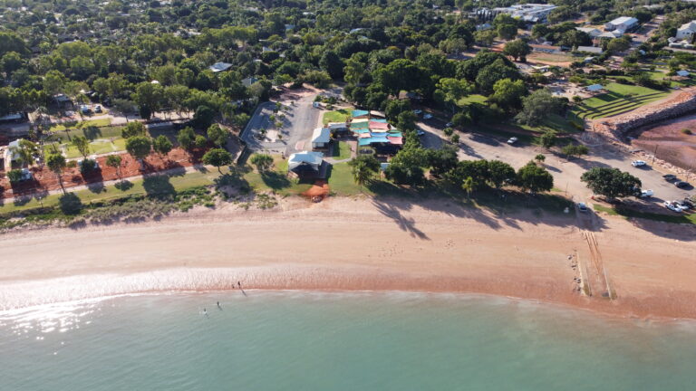
Land Insights has worked with Austral Bricks for several years, providing ongoing drone survey data services across multiple clay pit quarry sites in Western Australia. This aerial data has become a critical tool in supporting both day-to-day quarry management and longer-term environmental planning.
At each site, we use Remotely Piloted Aircraft (RPA) to capture high-resolution topographic and visual data with centimetre-level accuracy. Our team flies these surveys across key extraction areas as needed, depending on operational cycles and seasonal factors.
After each flight, we process the data in-house using advanced photogrammetry software. This allows us to generate 3D surface models, orthomosaic maps, digital terrain models, and accurate volume calculations.
Austral Bricks accesses this information through a secure online platform. The data supports a wide range of tasks, including water management, vegetation encroachment tracking, and stockpile measurement. It also contributes directly to development applications, planning approvals, and environmental reporting.
Our drone survey data has helped Austral Bricks reduce reliance on traditional ground surveys. It has also enabled faster decision-making, improved site oversight, and supported regulatory compliance.
This long-term partnership demonstrates our ability to deliver reliable, high-quality geospatial services to resource-based industries. In addition to drone operations, we assist Austral Bricks in preparing development applications and environmental documentation based on this spatial data.
Learn more about our drone mapping and monitoring services, or visit Austral Bricks to learn more about their clay manufacturing operations.